GK Cloud
The easiest way to export data from the GK Field Mapper is to use the GK Cloud.
The GK Cloud alows users to upload data and download through cloud.gktechinc.com. This allows you to easily access data from all your devices (such as downloading surveyed data to your PC). The GK Cloud also allows you to download the data into the file format of your choice (such as .shp, .dfx, .kml, etc).
The GK Cloud requires a username and password that must be initially set up through the GK Field Mapper App. Once created, you can log into the website to begin syncing your surveyed data to the GK Cloud. Then, navigate the the URL provided above to do begin downloading data.
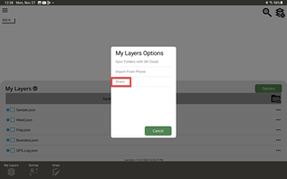
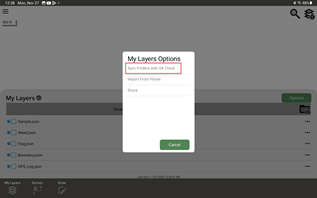
To export data through the GK Cloud, data from GK Field Mapper must first be synced to the GK Cloud. To begin, first go to "My Layers" and then push the green, "options" button.
Then, push "Sync Folders with GK Cloud"
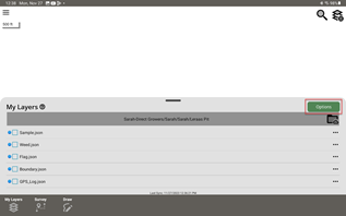
Select the files to sync or select all the files that exist. Then push the green "Sync" button.
The synced data is now accessable by downloading from the GK Cloud on any device